Nearby Hotels
Oyama Town, Sunto County, Shizuoka Prefecture
[Izu, Hakone, FujiFujiFoot of Mount Fuji]
Mountain climbing・Hiking
Universal ID:jp-tourism/69c19274-84d6-4298-b560-38773dca926d
Fujihakone Trail
official name:Fuji Hakone Trail
English name:Fuji Hakone Trail
Hakone, Fuji Trail
to

last updated:
to
- Mountain climbing・Hiking
- Recommendations
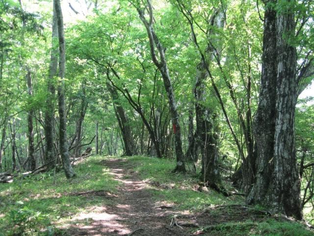
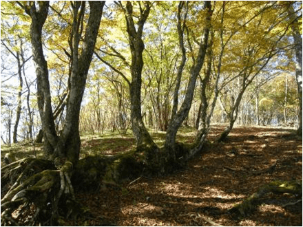
The Fuji-Hakone Trail is located on the prefectural border between Shizuoka, Yamanashi, and Kanagawa prefectures, and has a total length of approximately 43 kilometres. The trail runs from the Subashiri Route 5th Station of Mt. Fuji to Mt. Kintoki, and passes through West Tanzawa, which consists of Mt. Mikuni, Mt. Yufune, and Mt.Furo. From Mt. Kintoki, there is an additional route that connects to Hakone. Along the trail there are forests of beech, and other deciduous trees, and they have something different to offer in each of the four seasons. From spring to early summer, the area is coloured with many different types of flowers, and you can see the Hakone roses that are unique to this area.
Nearby Hotels
Basic Information
- Name
- Fuji Hakone Trail
- Location
- Oyama-cho, Sunto-gun, Shizuoka
More details
- Access
- JR Gotemba Line Suruga-Oyama Station Bus 25 minutes A hiking bus runs from Suruga-Oyama Station to Myojin Pass only on weekends and holidays from mid-April to late June and mid-September to late November (no return route).
Contact Us
- Oyama Town Office Commerce and Tourism Division
- TEL