
Nearby Hotels
Transit
Kusatsu Town, Agatsuma County, Gunma Prefecture
Seasonal outings
Shigakusatsukogen Ruth Kukudo 292 Gounokou
official name:Shiga Kusatsu Kogen Route (National highway No. 292)
English name:Shiga Kusatsu Kogen Route (National highway No. 292)
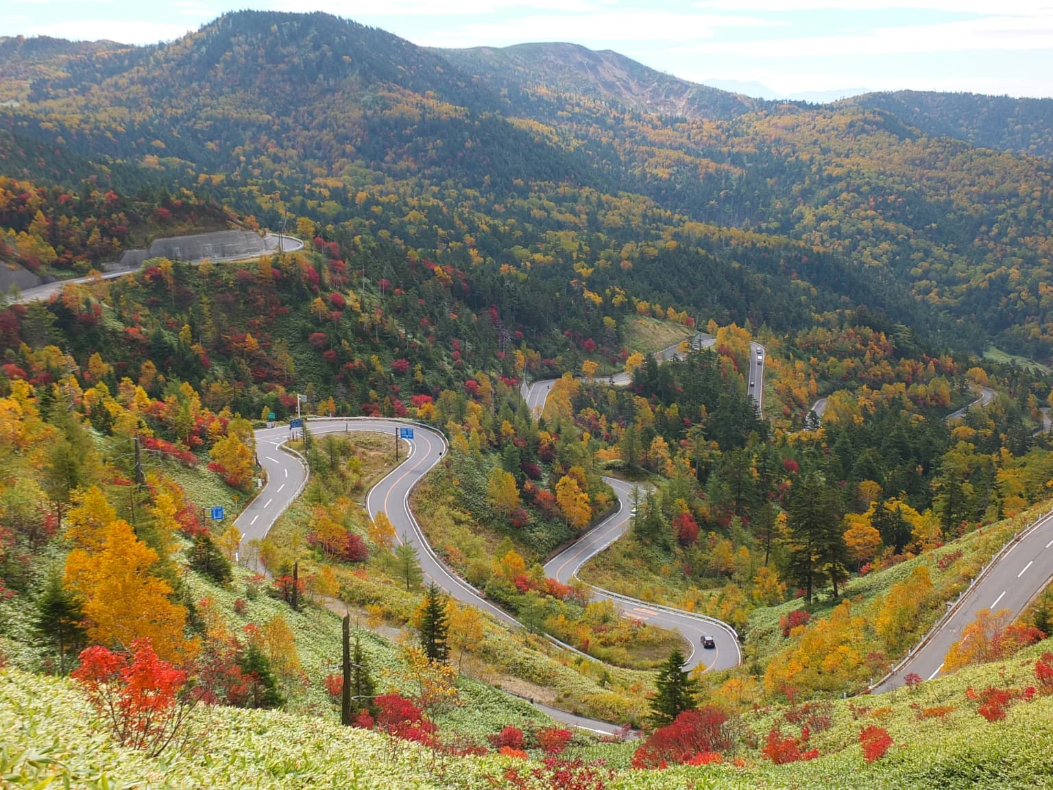
Autumn leaves on Shiga Kusatsu Kogen Route (National Route 292)
September to October

Kusatsu Onsen Tourist Association
last updated:
September to October
- Seasonal outings
- Autumn Foliage
Transit
Nearby Hotels
Basic Information
- Location
- 〒- Kusazu-cho, Azuma-gun, Gunma Prefecture, and Yamanouchi-cho, Shimotakai-gun, Nagano Prefecture
More details
- URL
- Access
- Approx. 2 hours (approx. 70 km) from the Kanetsu Expressway Shibukawa-Ikaho IC via National Route 17, 353, 145, and 292 from the Joshinetsu Expressway Shinshu-Nakano IC via National Route 292
- Parking Lot
- Free (5 regular cars at the highest point of Japan National Highway)
- Notes
- Closed in winter from mid-November to late April.
Nearby Highlights

Gunma Prefecture|Kusatsu Town, Agatsuma County
Mountains・Plateaus
Mt. Shirane (Kusatsu-cho, Gunma Prefecture)
Gunma Prefecture|Kusatsu Town, Agatsuma County
Lake
Yugama

Nagano Prefecture|Yamanouchi Town, Shimotakai County
Other famous places
The highest point of Japan National Highway

Gunma Prefecture|Kusatsu Town, Agatsuma County
Flowers・Plants
Autumn leaves in Mount Kusatsu-Shirane
Gunma Prefecture|Kusatsu Town, Agatsuma County
Lake
Yumiike Pond
Gunma Prefecture|Nakanojo Town, Agatsuma County
Lake
Yoshigadaira Wetlands
Gunma Prefecture|Tsumagoi Village, Agatsuma County
Japan Ryokan Association Member Ryokan
Manza Onsen Nisshin-kan

Nagano Prefecture|Yamanouchi Town, Shimotakai County
Mountains・Plateaus
Shibutoge
Gunma Prefecture|Tsumagoi Village, Agatsuma County
Hot springs
Manza Onsen
Gunma Prefecture|Tsumagoi Village, Agatsuma County
Mountains・Plateaus
Mt. Manza

Nagano Prefecture|Yamanouchi Town, Shimotakai County
Gondola・Lift
Shibutoge Romance Lift

Nagano Prefecture|Yamanouchi Town, Shimotakai County
Sea of clouds
Rime at the summit of Mt. Yokote

Nagano Prefecture|Yamanouchi Town, Shimotakai County
Outlook・Viewpoints
Mt.Yokoteyama Observation Deck

Nagano Prefecture|Yamanouchi Town, Shimotakai County
Mountains・Plateaus
Mount Yokote

Nagano Prefecture|Yamanouchi Town, Shimotakai County
Sea of clouds
The summit of Mt. Shiga-kogen Yokote
Gunma Prefecture|Tsumagoi Village, Agatsuma County
Japan Ryokan Association Member Ryokan
Manza Hotel Juraku
Nagano Prefecture|Yamanouchi Town, Shimotakai County
Social studies・Factory tours
to
Edelweiss Ski School

Gunma Prefecture|Tsumagoi Village, Agatsuma County
Japan Hotel Association Member Hotels
Manza Prince Hotel

Nagano Prefecture|Yamanouchi Town, Shimotakai County
Outlook・Viewpoints
2307 Full sky view terrace

Nagano Prefecture|Yamanouchi Town, Shimotakai County
2307 Sky Café
Map
Contact Us
- Kusatsu Onsen Tourist Association
- TEL
- Kusatsu Onsen Ski Resort
- TEL